
Country
Italy
Region/Province
South Tyrol
River basin
Aurino basin
Length
53 km
Main features
Alpine river under restoration since 2003 to improve ecological functionality, including channel widening, removal of bank protections, and reintroduction of sediments.
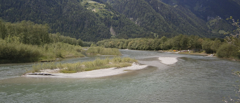
The Aurino River basin has a drainage area of 629 km2 and is located in South Tyrol, Italian Alps. The Aurino River, with its 53 km of length and 15.2 m3 s −1 of annual mean water discharge (30–50 m3 s −1 during the summer), is the most important tributary of the Rienz/Rienza River.
The river segment considered in this project lies in the lower, wider Ahr valley, where the channel features mostly partly confined conditions punctuated by debris flow fans determining shorter confined reaches. Gravel mining occurred in this river stretch from the 1950s to the1980s.
Bed incision became evident during the second half of the twentieth century, leading to a morphological and hydrological discontinuity between the channel and its floodplain, the latter being now a terrace flooded only by events with recurrence intervals >30–50 years, depending on the location.
Bed incision has also caused a lowering of the water table, probably limiting the growth and dynamics of riparian forest dominated by grey alder (Alnus incana) but certainly favouring conditions for agriculture and bed armouring.
In 2003 the Department of Hydraulic Engineering of the Autonomous Province of Bolzano started a river restoration program with the purpose of improving the ecological functionality of the river. The river restoration program consists mainly of the removal of river bank protections, channel widening, raising of the riverbed by introducing the sediments taken from the banks, and creation of islands. The restored reach (partly confined) is located near the village of Gais (about 1100 m in length, average slope of 0.1%). The current channel width is about 60 m, and the channel pattern is sinuous.