
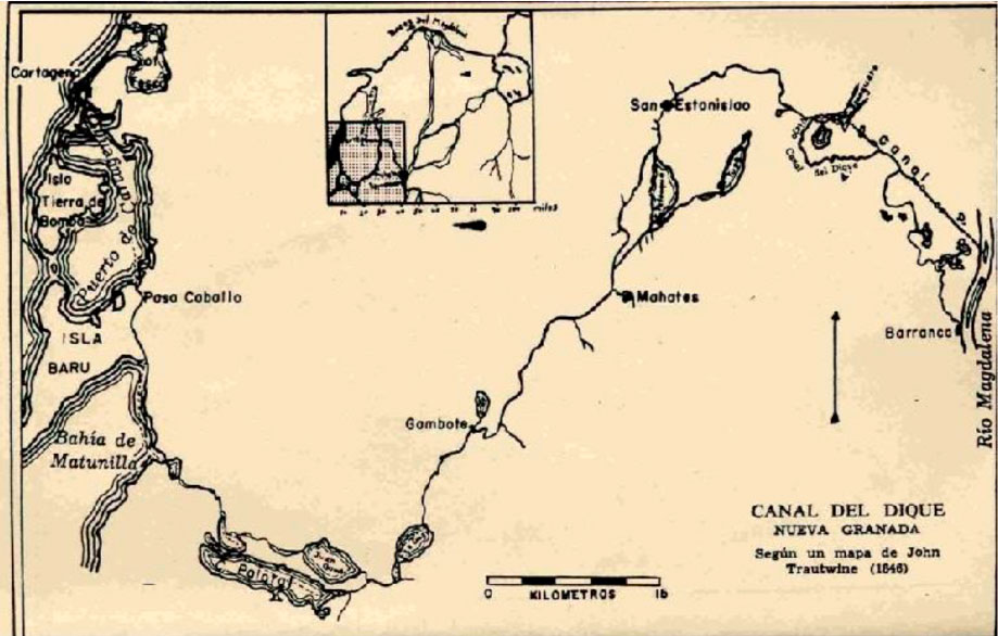
How do we advance river restoration that is truly socio-environmentally just? At the RiVIVE project, we believe that understanding the intricate historical ties between riverscapes, aquatic ecosystems, and human societies is paramount to creating inclusive and sustainable futures. A recent study supported by the European Biodiversity Partnership (Biodiversa+) and the European Research Council offers a detailed and objective case study on these very dynamics.
The paper, titled “Hydrosocial river modernization: The enclosure of amphibious cultures in Canal del Dique, Colombia” (2026) by Niek Schasfoort, Jaime Hoogesteger, and Bibiana Duarte-Abadía, examines how long-term engineering interventions have modified the river landscape and affected the traditional practices of local communities.
Understanding Amphibious Cultures
The concept of “amphibious culture” (cultura anfibia), originally described by Colombian sociologist Orlando Fals Borda, refers to communities whose economic and social activities are adapted to the seasonal variation of water levels.
In the floodplains of the Magdalena River, near the Canal del Dique, local populations have historically combined land- and water-based practices according to these natural cycles:
- The Wet Season: Higher water levels expand the wetland systems (ciénagas), making fishing the primary activity.
- The Dry Season: As water recedes, fertile floodplains (playones) become accessible for seasonal agriculture.
This dual livelihood strategy relied on open-access commons and natural hydrological connectivity, which also supported native migratory fish species such as the Bocachico.
Modern Hydrological Interventions and Landscape Changes
The Canal del Dique region has undergone significant structural modifications over the past several decades. While initial canals were built during the colonial period to improve navigation, modern engineering projects since the 1950s focused on reclaiming land for agricultural and livestock production.
To establish stable drylands, public and private actors implemented several structural changes:
- Wetland Drainage: Extensive systems of dikes and embankments were constructed, resulting in a reduction of approximately 70% to 80% of the original wetlands in the study area.
- Canal Rectification: During the 1980s, the canal was straightened to accommodate larger shipping vessels. This accelerated water velocity, increased sedimentation, and reduced the hydrological connection to adjacent swamps.
- Land Tenure Changes: The physical drying of the wetlands facilitated the transition to private land use, reducing the communal spaces historically used by small-scale farmers and fishers.
These interventions gradually shifted the regional economy from a dual amphibious model to a more terrestrial agricultural model.
Recent Flood Management and Stakeholder Perspectives
Following severe flooding events in 2010 and 2011, the Colombian government, through the Fondo Adaptación, initiated plans for a new large-scale infrastructure project designed to manage flood risks and regulate sedimentation.
The current project plan proposes the installation of major control structures and sluice gates at Calamar and Puerto Badel. This initiative represents a complex set of priorities for different stakeholders:
- Project Developers: Aim to stabilize water levels, guarantee year-round navigation, prevent catastrophic flooding, and protect urban areas and agricultural investments.
- Local Fishing Communities: Express concern that the physical isolation of the ciénagas from the main canal may restrict fish migration routes and reduce local fish populations, despite proposed mitigation measures like fish passages and restocking programs.
This divergence highlights the challenges of balancing regional infrastructure goals with local socio-economic needs.
The Riverhood Framework as an Analytical Tool
To analyze these shifting dynamics, the researchers apply the ‘Riverhood’ framework, which examines rivers as complex socio-natural systems across four main dimensions:
- River-as-eco-society: How human communities, ecosystems, and physical infrastructures interact at a given moment.
- River-as-subject: The different visions and development goals (such as transport, safety, or conservation) proposed for the river.
- River-as-territory: The planning, legal norms, and infrastructure projects used to organize and control water resources.
- River-as-movement: The grassroots organizations and social coalitions that advocate for local practices and cultural heritage.
The authors suggest that these dimensions operate dynamically over time, shaping new socio-ecological realities. For the RiVIVE project, this case study underscores that sustainable river restoration requires a balanced approach that integrates scientific data, regional planning, and the lived experiences of local communities.